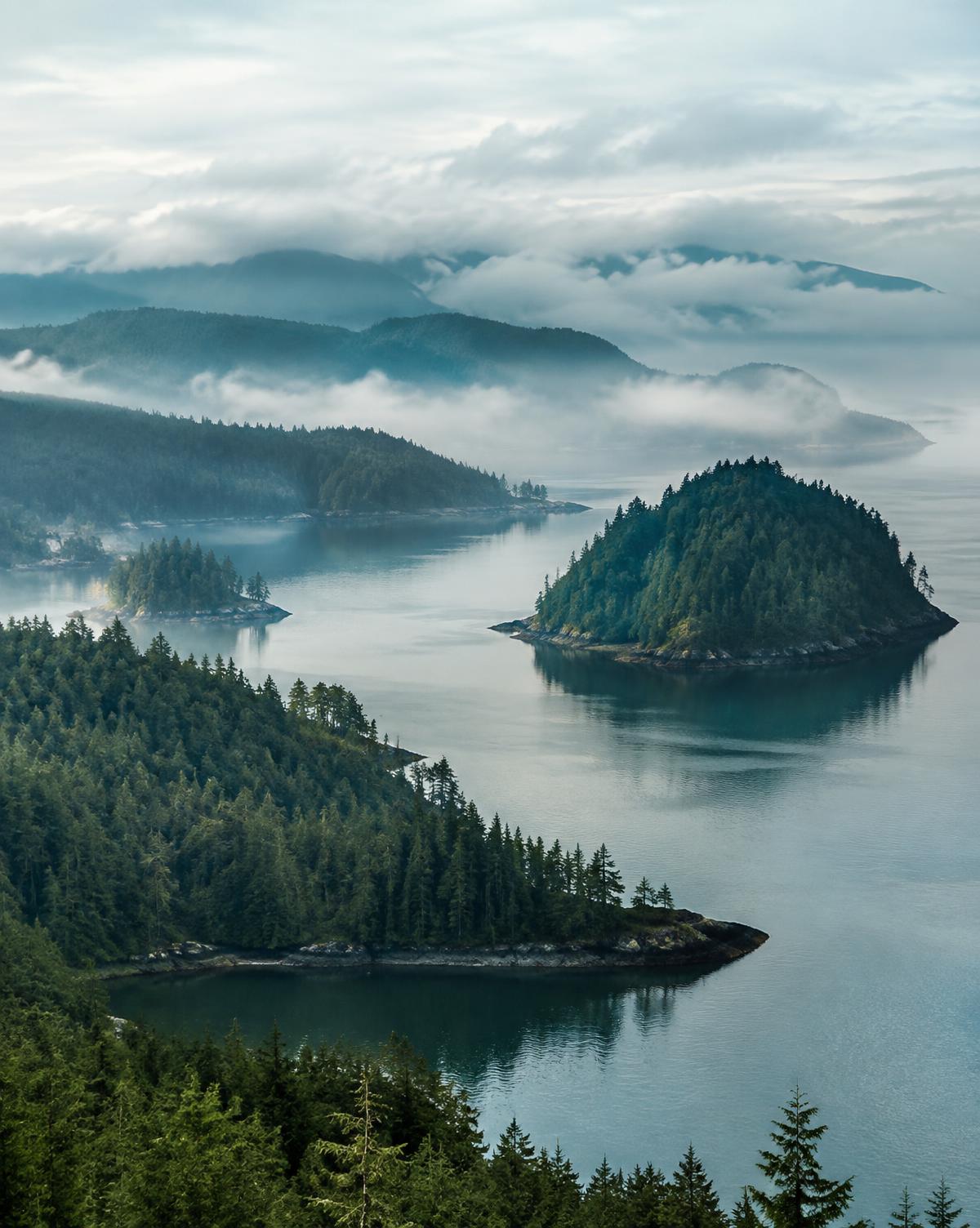
British Columbia, Canada
Coast, city and mountains within a single week.
Last reviewed September 2026
British Columbia suits travelers who want variety without long flights between stops: a walkable coastal city, a mountain resort town, island ferries and one of the most scenic highways in the country.
BRITISH COLUMBIA, CANADA at a Glance
Best for
Coastline • City & Mountains • Road Trips • Wildlife
- Ideal Stay
- 7 Days
- Best Months
- June to September; December to March for Whistler ski season
- Currency
- Canadian dollar (CAD)
- Language
- English
- Drive On
- Right
- Emergency
- 911
Official resources
Within British Columbia, Canada
Vancouver
Coastal city with excellent food, beaches and Stanley Park — a natural first and last stop.
Whistler
Two hours north on the Sea-to-Sky Highway; skiing in winter, hiking and biking in summer.
Victoria
Reached by ferry or floatplane; gardens, harbour walks and a slower pace.
Scenic British Columbia
Vancouver Island's west coast, the Okanagan wine region and the interior mountains.
Overview
A comfortable first trip runs Vancouver, then Whistler by the Sea-to-Sky Highway, then either Victoria and Vancouver Island by ferry or the Okanagan by road.
Ferries are part of the itinerary, not an afterthought — sailings should be reserved in summer.
Why Visit
Very few regions put a major city, an alpine resort and an island coastline within a few hours of one another.
- The Sea-to-Sky Highway is a genuine highlight in itself
- Strong wildlife viewing, including whales in season
- Good rainy-day options in Vancouver and Victoria
Best Time to Visit
July to September is driest and warmest, with full ferry and tour schedules. Spring and autumn are green and quiet with more rain. Winter is ski season in Whistler and mild but wet on the coast.
How Many Days You Need
Seven days covers Vancouver, Whistler and Victoria comfortably. Ten days allows Vancouver Island's west coast or the Okanagan as well.
Weather & When to Go
The coast is mild and rainy outside summer; mountain weather at Whistler differs sharply from the city on the same day.
Airports & Arrival
Vancouver International
YVRMain gateway, connected to downtown by rapid transit in about 25 minutes.
Airport transport
- SkyTrain Canada Line
- Rental cars
- Taxis and rideshare
- Private transfers
Victoria International
YYJUseful if you start on Vancouver Island rather than the mainland.
Airport transport
- Airport buses
- Taxis
- Rental cars
Flight schedules, fares and transport services change. Check official airport and operator information close to your travel date.
Getting Around
- Rental car for the Sea-to-Sky Highway and island touring
- Vancouver's SkyTrain, buses and SeaBus cover the city well without a car
- BC Ferries between the mainland and Vancouver Island — reserve in summer
- Floatplanes between Vancouver and Victoria harbours
- Coach services connect Vancouver and Whistler
- Distances: Vancouver to Whistler about 2 hours; ferry crossing to Victoria about 1.5 hours plus terminal time
Official operators: TransLink (Metro Vancouver transit). Check timetables close to your travel date.
Where to Stay
Choose the area before the property — it shapes the trip far more than the room does.
Vancouver — Downtown & Coal Harbour
Best for First visits
Walkable to Stanley Park, the seawall and transit.
Vancouver — Kitsilano
Best for Beaches and a local feel
Quieter, with good dining and easy access to the city.
Whistler Village
Best for Mountain stays
Car-free village centre with lifts, dining and trails on the doorstep.
Victoria — Inner Harbour
Best for Short island stays
Everything walkable from the ferry and floatplane terminals.
Maps & Routes
A useful BC map shows Vancouver, the Sea-to-Sky route north to Whistler, the ferry crossings to Vancouver Island, and the highway east toward the Okanagan.
Vancouver orientation
Airport, downtown and Stanley Park.
Open in Google MapsSea-to-Sky Highway to Whistler
Highway 99 via Horseshoe Bay and Squamish.
Open in Google MapsVancouver to Victoria by ferry
Tsawwassen to Swartz Bay, then south into Victoria.
Open in Google MapsVancouver Island west coast
Victoria north and west to Tofino and Ucluelet.
Open in Google Maps
Routes open in Google Maps for orientation. Drive times vary with season, traffic and road conditions — download offline maps before you travel.
Current weather & conditions
Seasonal patterns are a planning guide, not a forecast. Check current conditions for British Columbia, Canada in the days before you travel, and again before any driving or hiking day.
Check Current WeatherWhat to Pack
Packing
British Columbia packing
Adjust for your season and activities — this list is a starting point, not a requirement.
For U.S. Travelers
Before You Go — British Columbia, Canada
Practical starting points for the paperwork side of your trip. Entry, health and safety requirements change, so treat everything here as an orientation and confirm the details through official sources.
Passport & Entry Requirements
Requirements depend on your nationality, the purpose of your trip and how long you're staying. Check the official destination page before booking, and again before you fly.
U.S. Department of State destination informationVisa, eTA or Electronic Authorisation
Some destinations require a visa in advance, others an electronic authorisation, and many allow visa-free entry for short visits. These systems are added and amended periodically, so verify current rules through official channels rather than previous experience.
Passport Validity
Countries set their own validity rules — often several months beyond your date of entry. Airlines can deny boarding if your passport doesn't meet the destination's requirement.
Check current destination requirementsTravel Advisories
Advisories describe current conditions and practical considerations for each country. Read the destination page rather than the headline level alone.
Current travel advisoriesHealth & Vaccination Information
Official travel health pages list recommended and required vaccinations and current health notices by destination. We don't provide medical advice — speak with a qualified healthcare professional about your own circumstances.
CDC Travelers' Health destination listSTEP — Smart Traveler Enrollment Program
A free U.S. Department of State service that lets citizens and nationals enrol their trip with the nearest embassy or consulate, receive destination safety updates, and be contacted more easily in an emergency.
Official STEP informationEmergency Information
Note the local emergency number and the location of the nearest U.S. embassy or consulate before you travel. Keep emergency contacts written down as well as stored on your phone.
Nearest U.S. embassy or consulateEntry requirements, advisories, health guidance and regulations change without notice. This section was last reviewed in September 2026 and is editorial guidance only — it is not an official source and should never be relied on in place of current government information.
Safety & Travel Preparedness
Sensible preparation rather than worry. A short checklist covers most of what matters.
- Read the current official travel advisory for your destination.
- Note the local emergency number — 911 here and save it in your phone.
- Locate the nearest embassy or consulate and note its contact details.
- Keep digital and paper copies of your passport and key confirmations.
- Keep your accommodation address written down, including in the local language.
- Review travel insurance terms against your actual itinerary.
- Arrange phone and data access before you land.
Frequently Asked Questions
- Do I need a car in Vancouver?
- No. The city is well served by transit. Rent a car for the day you head to Whistler or the island instead.
- Can I visit Victoria as a day trip?
- It is possible but long. An overnight makes the ferry time worthwhile.